 By Saurav Mehra
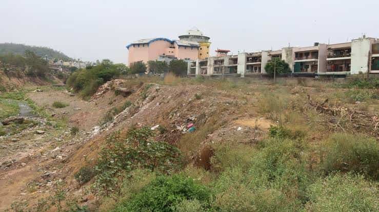
 Amravati Enclave is a large, established residential township in the Pinjore-Kalka belt of Panchkula district, Haryana, positioned close to Chandimandir, Surajpur and the Chandigarh-Shimla highway corridor. Set against the foothills of the Shivaliks, the locality offers a noticeably different residential environment from central Panchkula, combining apartments, independent houses and plots with comparatively open surroundings and convenient access towards Panchkula, Chandigarh, Pinjore and Kalka.
The locality is officially recognised by the Panchkula district administration, which maintains a separate postal entry for Amravati Enclave with PIN code 134105. Haryana RERA also records an Amravati Enclave residential project at P.O. Chandimandir in Kalka tehsil, promoted by Amar Nath Aggarwal Investments Pvt. Ltd.
One of the strongest features of the neighbourhood is that essential infrastructure has developed within and immediately around it. Amravati Vidyalaya operates inside the enclave, Aravali International School is located near it, healthcare is available towards Surajpur, Kalka and Panchkula, and the highway corridor provides access to the wider Chandigarh Tricity.
Quick Overview
| Particular | Details |
| Area | Amravati Enclave, Panchkula |
| Location Belt | Pinjore-Kalka Urban Complex |
| District | Panchkula, Haryana |
| Official Locality PIN Code | 134105 |
| Area Type | Established residential township |
| Housing Character | Residential plots, independent houses and apartments |
| Major Road Connection | Chandigarh-Pinjore-Kalka-Shimla highway corridor |
| Railway Access | Chandimandir, Pinjore and Kalka side railway connections |
| Major School Within Locality | Amravati Vidyalaya |
| Other School Nearby | Aravali International School |
| Government Healthcare Nearby | PHC Surajpur, Sub Division Hospital Kalka, General Hospital Panchkula |
| Major Employment Access | Panchkula, Chandigarh, Pinjore, Parwanoo and Chandigarh Technology Park |
| Nearby Areas | DLF Valley, Surajpur, Pinjore, Chandimandir, Kalka and Panchkula |
| Known For | Shivalik foothill setting, plotted housing, apartments and highway connectivity |
Where Is Amravati Enclave Located?
Amravati Enclave lies in the Pinjore-Kalka Urban Complex, north of the main Panchkula city area. Haryana RERA records the project location as P.O. Chandimandir, Tehsil Kalka, District Panchkula, while mapping records place the locality around Pinjore.
The enclave is close to DLF Valley and the Surajpur-Pinjore belt. It also sits alongside the traditional Chandigarh-Kalka-Shimla road corridor, which historically carried the NH-22 designation. The neighbouring DLF Valley development identifies Amravati Enclave directly to its south and the highway to its west, helping establish the enclave’s position within this expanding foothill residential zone.
Important surrounding destinations include:
- Pinjore
- Surajpur
- Chandimandir
- Kalka
- DLF Valley
- Panchkula city
- Parwanoo
This location makes Amravati Enclave particularly relevant for households that want access to both the Chandigarh Tricity and the Pinjore-Kalka side.
Why Is Amravati Enclave Known?
Amravati Enclave is mainly known for:
- A large established residential township environment.
- Independent houses and residential plots.
- Apartment developments within the wider enclave.
- Shivalik foothill surroundings.
- Direct access to the Pinjore-Kalka-Chandigarh corridor.
- Amravati Vidyalaya within the locality.
- Aravali International School near the enclave.
- Proximity to DLF Valley.
- Access towards Pinjore, Kalka and Panchkula.
- Local shopping and community facilities.
- Residential options that are generally lower-density than central Chandigarh.
Amravati Vidyalaya describes the broader enclave as a large green residential environment and identifies itself as being situated within Amravati Enclave. The school is also officially recognised by CBSE as a senior secondary institution.
Road and Public Transport Connectivity
Road connectivity is the most important transport strength of Amravati Enclave.
The locality lies close to the Chandigarh-Pinjore-Kalka-Shimla highway corridor, providing access south towards Panchkula and Chandigarh and north towards Pinjore, Kalka and Himachal Pradesh. Historical reporting also identifies Amravati Enclave as being located alongside the former NH-22 corridor.
Important travel directions include:
- Panchkula – for government offices, hospitals, shopping and employment.
- Chandigarh – for offices, education, healthcare and commercial activity.
- Pinjore – for local markets and everyday services.
- Kalka – an important transport and railway town.
- Parwanoo – industrial and commercial destination across the Himachal Pradesh border.
- Chandimandir – cantonment and railway-side area close to the enclave.
Residents generally depend on private cars, two-wheelers, buses, autos and app-based cabs. For people commuting daily to Chandigarh or central Panchkula, peak-hour highway conditions should be considered when choosing a property.
Railway and Airport Connectivity
Unlike Chandigarh’s urban sectors, Amravati Enclave does not have metro connectivity. Rail and road transport are therefore more important.
Chandimandir Railway Station is accessible from the locality, while Pinjore and Kalka provide additional railway options. Kalka is particularly important because it serves as the terminus of the historic Kalka-Shimla railway and lies on the Chandigarh-Shimla route. Panchkula district administration describes Kalka as a gateway to Himachal Pradesh and an important railway town.
For air travel, residents use Chandigarh Airport through the Panchkula-Chandigarh road network.
Residential Market and Housing Options
Amravati Enclave has a broader housing mix than a single apartment project.
Common residential choices include:
- Residential plots.
- Independent houses.
- Villas and larger family homes.
- Builder-floor properties.
- 2 BHK apartments.
- 3 BHK apartments.
- Larger residential flats.
- Resale homes in established portions of the enclave.
Current property listings continue to show plots, apartments and independent floors in Amravati Enclave, indicating an active resale market.
The Haryana RERA-registered Amravati Enclave project is recorded on 16.156 acres. Its registration is HRERA-PKL-PKL-56-2018, with project ID RERA-PKL-704-2019. Importantly, the authority records show that an extension was approved on 28 January 2026, with the registered validity currently shown up to 31 January 2027.
Because the name Amravati Enclave covers a wider residential area as well as specific development components, buyers should verify exactly which plot, apartment block or project phase a property belongs to.
Important checks include:
- Sale deed and ownership chain.
- RERA registration where applicable.
- Plot and building approvals.
- Exact road and access rights.
- Parking allocation.
- Maintenance charges.
- Water and power arrangements.
- Association or society dues.
Schools and Educational Facilities
Schools Within and Around Amravati Enclave
Education is one of the locality’s stronger social-infrastructure features.
- Amravati Vidyalaya – located within Amravati Enclave and affiliated with CBSE at senior secondary level. CBSE records its affiliation through March 2028.
- Aravali International School – district records place the school at DLF Valley, Sector 3, Pinjore-Kalka Urban Complex, near Amravati Enclave.
- Amarnath Aggarwal Memorial School – listed by Panchkula district administration near Amravati Enclave.
- Army Public School, Chandimandir – another established option in the wider area.
Having a CBSE senior secondary school within the enclave itself is particularly convenient for families with school-going children.
Hospitals and Healthcare
Residents have access to local healthcare as well as larger hospitals in Kalka and Panchkula.
Important government facilities include:
- PHC Surajpur – government primary healthcare facility at Surajpur, Pinjore.
- Sub Division Hospital Kalka – government hospital serving the Kalka area.
- General Hospital, Sector 6 Panchkula – major government healthcare facility in Panchkula city.
Private healthcare options are also available towards Panchkula. Alchemist Hospital in Sector 21 Panchkula, for example, provides emergency, critical-care and multispeciality services.
For routine requirements, pharmacies and smaller clinics are available throughout the Pinjore-Surajpur-Amravati belt.
Shopping and Everyday Facilities
Amravati Enclave has developed its own neighbourhood commercial activity, while larger markets are available in Pinjore and Panchkula.
Residents can access:
- Grocery and convenience shops.
- Restaurants and cafés.
- Local service businesses.
- Shopping establishments within the enclave.
- Pinjore markets.
- Panchkula sector markets for wider retail.
- Chandigarh for malls, branded shopping and entertainment.
Current local business records show restaurants and shopping establishments within Amravati Enclave itself, particularly around its Sector 2 and City Center side.
Employment and Business Hubs Nearby
Amravati Enclave is primarily residential, but its location gives residents access to several different employment corridors.
Important destinations include:
- Panchkula – government, healthcare, retail and service-sector employment.
- Chandigarh – major government, education, healthcare and private-sector employment centre.
- Rajiv Gandhi Chandigarh Technology Park – an established IT and business district with technology-company campuses. Chandigarh Administration identifies it as a major IT development.
- Pinjore and Kalka – local commercial, institutional and service activity.
- Parwanoo – industrial and commercial employment across the Haryana-Himachal border.
- Baddi-Nalagarh belt – a major industrial direction accessible through the wider Pinjore region.
The location can therefore suit households whose members work in different parts of Panchkula, Chandigarh or the northern industrial belt.
Nearby Areas Around Amravati Enclave
- DLF Valley – major residential development directly adjoining the enclave.
- Surajpur – nearby settlement with government healthcare facilities.
- Pinjore – established town with markets and transport facilities.
- Chandimandir – cantonment and railway-side locality.
- Kalka – important railway and gateway town towards Himachal Pradesh.
- Panchkula – principal planned city and district headquarters.
- Parwanoo – neighbouring Himachal Pradesh industrial town.
- Islam Nagar/Aslam Nagar – residential area adjoining the wider development belt.
FAQs
Q1. Is Amravati Enclave in Panchkula or Pinjore?
Both names commonly appear in addresses. Amravati Enclave is in Panchkula district and falls within the Pinjore-Kalka belt. Haryana RERA records the project under Kalka tehsil, while mapping and local addresses commonly describe it as Pinjore, Panchkula.
Q2. What is the PIN code of Amravati Enclave?
Panchkula district administration maintains a dedicated postal listing for Amravati Enclave with PIN code 134105. Some institutions in the adjoining Chandimandir-Surajpur belt may use different nearby postal codes, so the exact building address should still be checked.
Q3. Is there a school within Amravati Enclave?
Yes. Amravati Vidyalaya is located within the enclave and is a CBSE-affiliated senior secondary school.
Q4. What type of properties are available in Amravati Enclave?
The wider residential market includes plots, independent houses, builder floors and apartments. Therefore, buyers should confirm whether a listing relates to a plot, an established independent property or a particular apartment development.
Q5. Is the Amravati Enclave project registered with Haryana RERA?
Yes. Haryana RERA lists Amravati Enclave under registration HRERA-PKL-PKL-56-2018 and project ID RERA-PKL-704-2019. The authority records show an extension approved in January 2026, with the current registration period shown through January 2027.